
Exploration · 4 min 3 sec read · 11 sections · Free access
GTA 6 Map Locations: Confirmed Places in Leonida
Where everything is in Leonida, from Rockstar's official map: the five counties, the six regions, and the towns, islands and landmarks in each. Pairs with our interactive map.
Official-evidence guide · Updated 19 November 2026 with Rockstar’s official Leonida map. Positions come from the labels on that map; mission spots and collectibles are not covered.
Interactive map · freeOpen Rockstar's official Leonida map and zoom to any place in this guide- 01
Rockstar’s official map of Leonida
On launch day, 19 November 2026, Rockstar put a full map of Leonida on its GTA VI downloads page, free, with a print version at 19.25 × 26.33 inches. It labels five counties, over a hundred towns, islands and landmarks, and every main road. Your in-game map starts covered and clears as you explore, so this is the quickest way to see the whole state. Open it on our interactive map to zoom, search and tick off places.
- 02
The five counties at a glance
Lummox County covers the hilly, forested north, including Mount Kalaga National Park, Grayson and Bonanza. Kelly County is the west, from Port Gellhorn and Draper Island to Emerald Springs and Capri. Leonard County is the east, around Lake Leonida, Belville, Millport and Waning Sands. Vice-Dale County is the south-east, holding Vice City, Vice Beach and Vice City International Airport. Mariana County is the south: Grassrivers, Watson Bay and the chain of keys down to Mile Zero Air Station.
- 03
Rockstar’s six regions
Rockstar’s Only in Leonida page names six destinations: Vice City, Leonida Keys, Grassrivers, Port Gellhorn, Ambrosia and Mount Kalaga. On the official map, Vice City sits on the south-east coast, Port Gellhorn on the west (Gulf) coast, Ambrosia in the middle on Highway 35, Mount Kalaga in the north, Grassrivers in the south-west wetlands, and the Keys run south from Hamlet.
- 04
Vice City, Ocean Beach and VC Port
Vice City is the urban destination at the centre of Rockstar’s revealed world. Its official description names Ocean Beach, Little Cuba, the Tisha-Wocka flea market and VC Port. The official map places Little Cuba and Downtown side by side in the city centre, Port Vice City on its own island in the bay, and Ocean Beach at the south end of Vice Beach, across the water to the east. The launch gallery also shows a marina against the Vice City skyline, a crowded city nightclub and a drawbridge facing the skyline.
- 05
Leonida Keys
Rockstar describes the Leonida Keys as a tropical archipelago with a relaxed island culture and dangerous surrounding waters. Jason’s official biography places his work for local drug runners in the Keys, while Brian Heder’s biography names a boat yard used for his smuggling operation. On the official map the chain starts at Hamlet and runs south past Shoeless Keys and Key Lento, then west over a long bridge road to Southwind and Mile Zero Air Station. The map names each key rather than printing “Leonida Keys”.
- 06
Grassrivers
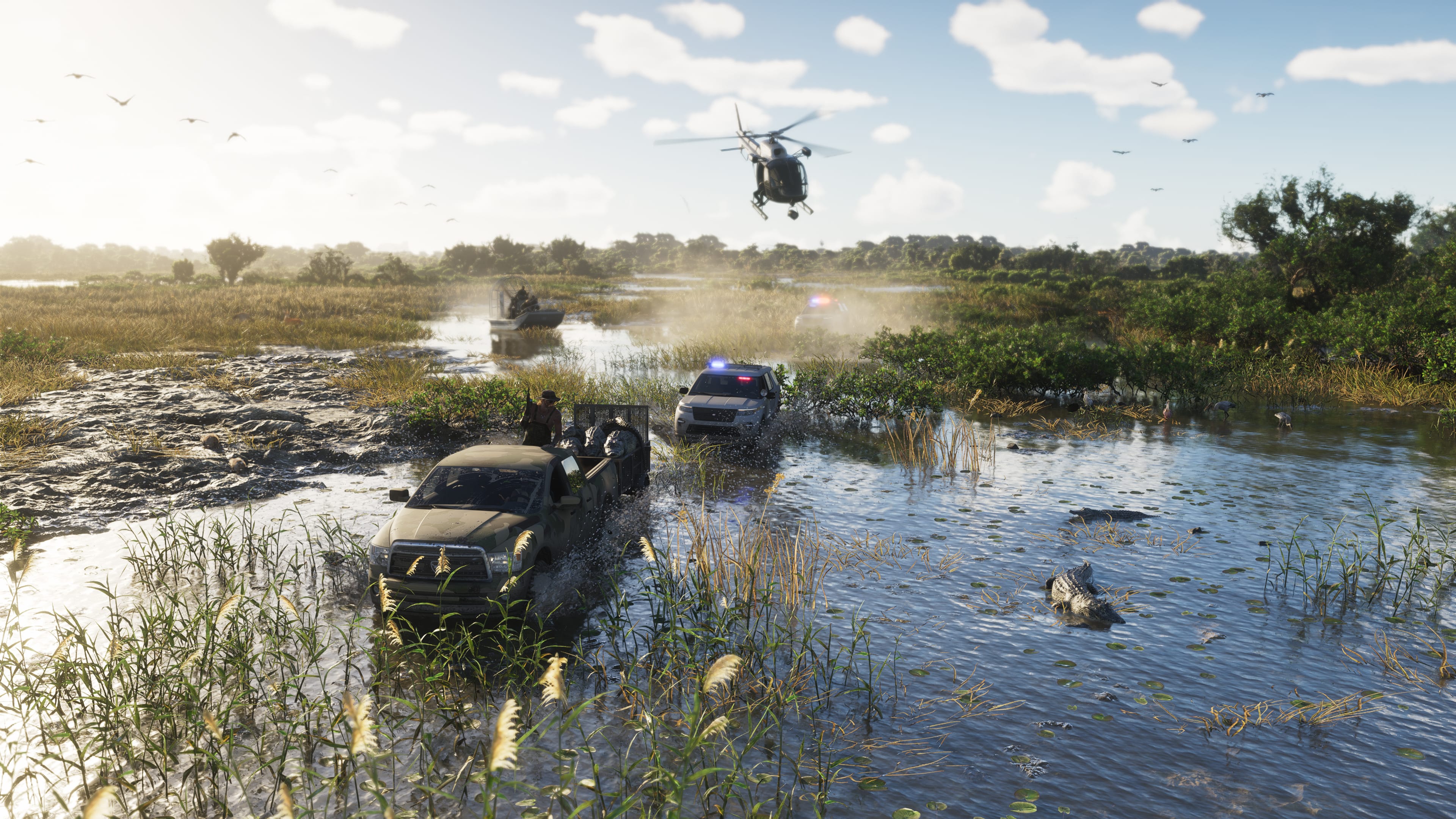
Grassrivers is Rockstar’s wetland destination, with mangroves, alligators and other wildlife. An official launch-gallery screenshot shows an alligator in swamp water as an airboat approaches through mangroves. That is direct visual evidence of the setting, not proof of a collectible spawn, mission start or repeatable route. On the official map, Grassrivers is in Mariana County, between Big Pine and Hamlet, south of the airport.
- 07
Port Gellhorn
Port Gellhorn is presented as a faded coastal vacation area with inexpensive motels, closed attractions and quiet strip malls. The official map puts it on the west coast of Kelly County, facing Draper Island across Draper Bay, with Interstate 404 running past it.
- 08
Ambrosia and Allied Crystal
Ambrosia is an industrial destination in the heart of Leonida. Rockstar names the Allied Crystal sugar refinery as a major local employer and describes a local biker gang as another powerful presence. On the official map, Ambrosia sits right in the middle of the state on Highway 35, west of Lake Leonida. Allied Crystal’s exact building is not labelled on the map.
- 09
Mount Kalaga
Mount Kalaga is the one destination for which Rockstar gives a broad directional clue: its official description places it near Leonida’s northern border. Rockstar also describes hunting, fishing and off-road trails in the surrounding backcountry. The official map confirms it: Mount Kalaga National Park fills the hills of Lummox County in the north.
- 10
Named places in the launch gallery
Rockstar’s official screenshot descriptions name a Fleeca bank branch, The Rusty Anchor bar and Delights Cabaret. These names can be included in a confirmed-location index because Rockstar published them directly. The images alone do not verify where the buildings sit on the full map, whether players can enter them outside a particular scene, or what activities they contain.
- 11
What the map does not show
The official map is a place-name map. It does not mark mission starts, collectibles, safehouses or shop interiors, and its pins on our interactive map sit on Rockstar’s printed labels, not on exact in-game coordinates. When we add collectible or activity spots, each one will say which game version and platform we checked it on.
Sources
VICE COAST INTEL / GUIDE HELPER
Ask about this guide
Loading account…